

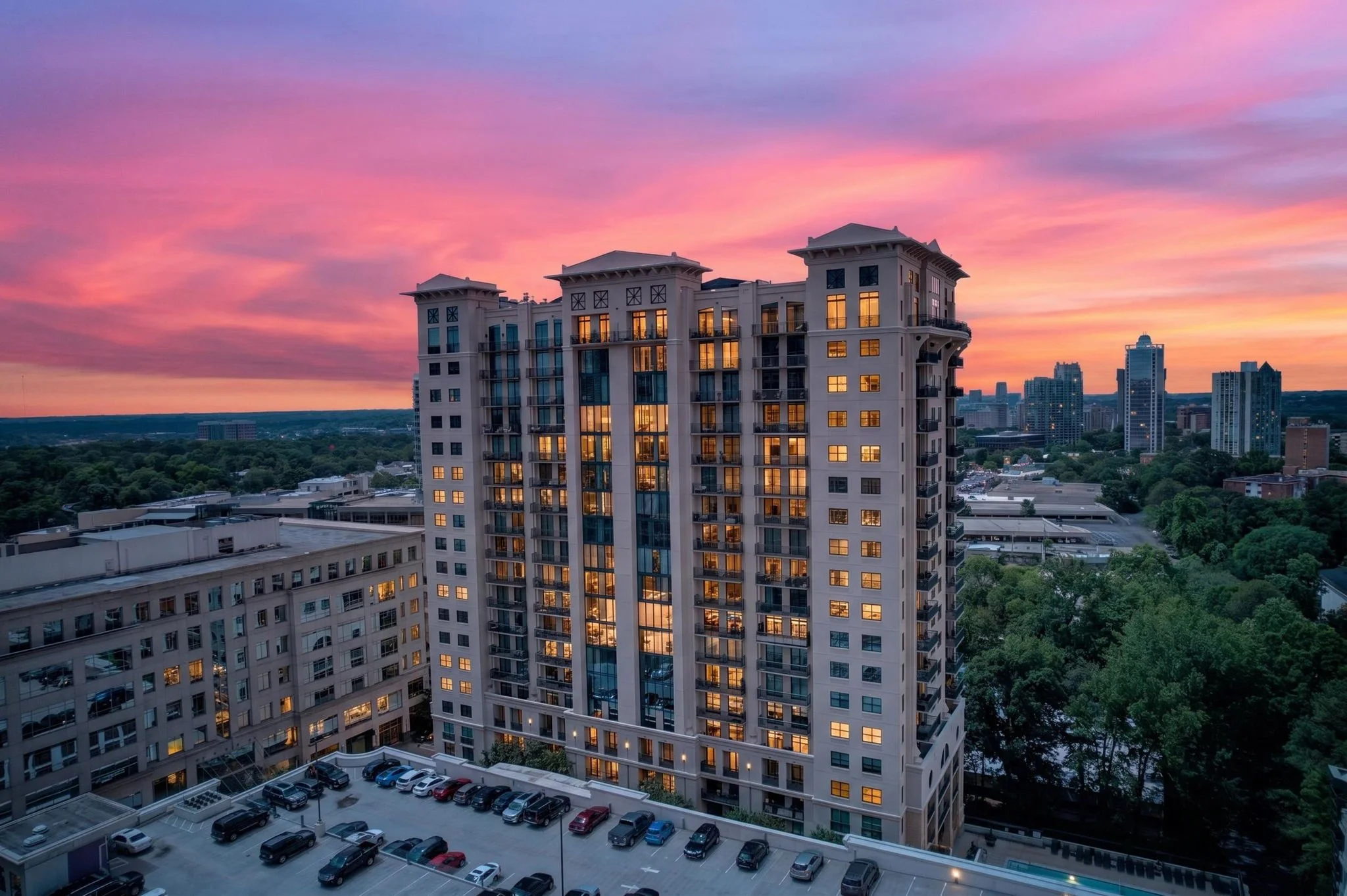
A Different Perspective.
A Better Picture.
Real Estate Drone Photography & Video in Atlanta, GA
See the home. Discover everything around it.
WHY DRONE MEDIA MATTERS
Show Buyers What They Can't See From the Ground.
Imagine you're selling a beautiful home sitting on five acres.
You can photograph the kitchen, living room, bedrooms, and backyard. But how do you show buyers the full extent of the land they're purchasing?
That's where drone photography comes in.
Aerial photography gives buyers a bird's-eye perspective of the property, helping them understand the layout, surrounding land, and relationship between the home and its environment.
It can reveal features that traditional photography simply cannot capture from the ground.
The driveway leading up to the property.
The expansive backyard.
The surrounding acreage.
The beautiful architecture of the home.
The neighborhood park just down the street.
Or the golf course sitting beyond the backyard.
Because sometimes the biggest selling point isn't just the home itself. It's everything surrounding it.
DRONE PHOTOGRAPHY
Capture the Property From Every Angle.
Our aerial photography is designed to showcase the property from perspectives that help buyers better understand its size, layout, architecture, and location.
When you book drone photography with Soldwell, our team identifies the angles that best showcase your listing.
Depending on the property, your aerial gallery may include:
Front exterior aerial photography
Elevated architectural perspectives
Left and right exterior angles
Backyard and outdoor living areas
Overhead property views
Roof perspectives
Surrounding acreage
Streets and neighborhood views
Community amenities
Nearby attractions and geographical features
Our standard à la carte drone photography service includes approximately 5–10 professionally edited aerial images.
Drone photography is also included in our Showcase and Signature listing packages, with approximately five aerial images included at no additional charge.
[Schedule Your Listing]
DRONE VIDEOGRAPHY
Bring the Bigger Picture to Life.
Aerial video allows viewers to experience a property from a perspective that ground-level filmmaking cannot provide.
Rather than simply hovering above the home, we use intentional camera movements to introduce the property and establish its surroundings.
Our aerial filmmaking techniques can include:
Cinematic property reveals
Smooth approaches toward the home
Pull-away shots revealing the surrounding landscape
Architectural orbits
Overhead movements
Neighborhood establishing shots
Driveway and road perspectives
Sweeping landscape and acreage footage
Every movement serves a purpose.
Sometimes we want buyers to discover the home gradually.
Other times, we want to reveal its surroundings, architecture, or unique location.
The goal isn't simply to fly the drone. It's to show buyers something meaningful.
Standalone Drone Videos
Our à la carte drone videography service includes a professionally edited aerial video approximately 30–45 seconds long.
This option is ideal for Realtors who want to showcase a property's exterior, surrounding acreage, architecture, or neighborhood through aerial footage alone.
Drone Footage in Listing Videos
Drone footage is also incorporated into our Listing Reels and Cinematic Property Films when flight conditions allow.
Whether we're introducing the property, showcasing the backyard, or creating a cinematic ending, aerial footage helps connect the home to the environment around it.
A separate, standalone drone video can be purchased as an additional service.
NOT JUST FOR LUXURY HOMES
Every Property Has a Bigger Picture.
You don't need to be selling a multimillion-dollar estate to benefit from drone photography.
Aerial media can add valuable context to properties of all sizes.
Acreage & Large Lots
Show buyers the layout of the land, the relationship between buildings, and the space surrounding the home.
Luxury Homes
Highlight exterior architecture, landscaping, outdoor living spaces, and the scale of the property.
Golf Communities
Show the property's proximity to golf courses, community amenities, and the surrounding landscape.
Mountain & Vacation Properties
Capture mountain views, surrounding forests, scenic landscapes, and the property's natural setting.
New Construction
Showcase the home's exterior architecture, lot, neighborhood, and surrounding development.
Commercial Properties
Help potential buyers and tenants understand a property's location, building footprint, access points, and surrounding infrastructure.
Suburban Homes
Even a traditional suburban listing can benefit from aerial photography.
Perhaps the seller recently replaced the roof.
Maybe the property has an expansive backyard that isn't immediately apparent from ground-level photographs.
Or perhaps the home is located near a beautiful neighborhood park, community pool, or walking trail.
Aerial photography can help buyers discover those features before they schedule a showing.
A property doesn't need to be extraordinary to deserve a great perspective.
SELL THE LOCATION
A Home Is More Than Its Four Walls.
When someone purchases a home, they're also choosing the environment surrounding it.
The neighborhood.
The streets.
The nearby parks.
The local amenities.
The surrounding landscape.
Aerial photography can help Realtors show those elements in a way that traditional interior photography cannot.
For example, a buyer looking at a home in a golf community may want to understand how close the property sits to the course.
A family may appreciate seeing the neighborhood park within the surrounding community.
Someone purchasing acreage may want to understand the relationship between the house, land, and nearby properties.
By capturing these perspectives, we help buyers develop a clearer understanding of the property and its location.
Don't just show buyers where they'll live. Help them discover what's around them.
OUR APPROACH
Every Flight Has a Purpose.
There's a difference between flying a drone above a property and creating aerial media that supports a listing.
Before capturing footage, we consider what makes the property worth seeing from above.
Is it the acreage?
The architecture?
The neighborhood?
The surrounding landscape?
The outdoor living space?
Or is it simply a beautiful exterior angle that gives buyers a better understanding of the home?
We use the answers to plan the aerial photography and video around the property's strongest features.
We don't believe every listing needs the same aerial shots.
Some properties benefit from a higher perspective that showcases the surrounding landscape.
Others are better represented through lower, architectural angles that emphasize the home's exterior.
The property determines the perspective.
Our job is to identify the shots that help you market it effectively.
PROFESSIONAL EDITING
The Details Matter From Above, Too.
Our aerial photography doesn't stop when the drone lands.
We professionally edit the images to create polished, high-quality visuals that complement the rest of your listing media.
Depending on your property's needs, additional editing services may include:
Sky replacement
Grass and lawn enhancement
Property boundary overlays
Virtual lot lines
Neighborhood markers
Location labels
Directional arrows
Amenity highlights
These enhancements are available as add-ons, depending on the complexity of the request.
Show Buyers Where the Property Begins and Ends.
For properties with significant acreage, we can also add visual boundary overlays to aerial images.
This helps potential buyers better understand the approximate layout of the property and its relationship to surrounding land.
Property boundaries must be supported by information provided by the Realtor or property owner.
Boundary overlays are approximate visual representations intended for marketing purposes and do not replace a professional property survey.
LICENSED & INSURED
Professional Results. Responsible Flying.
At Soldwell, we believe great aerial media begins with safe and responsible drone operations.
Every Soldwell drone operation is performed by an FAA Part 107-certified remote pilot, and our drone operators are insured.
Before arriving at your property, we research the location to determine whether drone operations are permitted.
Our preflight planning includes reviewing applicable airspace restrictions, authorization requirements, weather conditions, and potential safety concerns.
We also assess the property and surrounding environment to determine how we can capture the footage safely.
Whether we're photographing a residential listing, commercial property, or expansive acreage, the same standard applies.
Safety comes first. Great media follows.
WHAT IF WE CAN'T FLY?
We'll Handle the Aviation Side.
Not every property can be photographed from the air.
Temporary airspace restrictions, weather, nearby airports, poor visibility, and other safety conditions may prevent drone operations.
Some locations may also require special authorization before flying.
When necessary, our team will handle the applicable airspace authorization process.
If we determine that we cannot legally or safely fly at your property, we'll communicate with you and discuss the available options.
In many situations, we can reschedule the aerial portion of your appointment for another day.
If rescheduling is not possible, we'll work with you on an appropriate solution, including a refund of the drone portion when applicable.
Our goal is to make the process as simple as possible for you.
You focus on your listing. We'll handle the drone.
FAST TURNAROUND
Your Listing Shouldn't Have to Wait.
We understand that Realtors often work with tight listing schedules.
Our standard turnaround for aerial photography and video is within 48 hours.
For standalone drone photography, you'll receive your professionally edited aerial images within our standard delivery window.
When drone footage is incorporated into your Listing Reel or Cinematic Property Film, it will be delivered as part of the completed video.
If weather, airspace restrictions, or other unforeseen circumstances affect the filming schedule, we'll communicate with you about any necessary changes to the delivery timeline.
PART OF THE COMPLETE LISTING EXPERIENCE
One Team. Every Perspective.
Drone photography shouldn't feel like a separate project you have to coordinate.
That's why aerial media can be incorporated into your Soldwell listing appointment alongside professional photography, videography, and other media services.
Our goal is to help you create a complete visual presentation of the property without having to coordinate multiple media vendors.
Essentials Package
Professional real estate photography, a floor plan, and a property website.
Drone photography and standalone drone video are available as additional services.
Showcase Package
Includes approximately five aerial photographs at no additional charge.
Drone footage is also incorporated into your Listing Reel when flight conditions allow.
Signature Package
Includes approximately five aerial photographs at no additional charge.
Drone footage can be incorporated into both your vertical Listing Reel and horizontal Cinematic Property Film.
Standalone drone videos are available as an additional service.
More perspectives. One media team.
FREQUENTLY ASKED QUESTIONS
How many drone photographs will I receive?
Our à la carte drone photography service typically includes approximately 5–10 professionally edited aerial images.
Our Showcase and Signature packages include approximately five aerial photographs at no additional charge.
The final number of images may vary depending on the property, available perspectives, and flight conditions.
How long is a standalone drone video?
Our standalone drone videos are approximately 30–45 seconds long and professionally edited to showcase the property's exterior, architecture, land, and surroundings.
Is drone photography included in your listing packages?
Yes. Our Showcase and Signature packages include approximately five aerial photographs at no additional charge.
Drone photography can also be added separately to the Essentials package.
Is drone video included with real estate video?
Drone footage is normally incorporated into our Listing Reels and Cinematic Property Films when flight conditions allow.
A separately edited, standalone drone video is available as an additional service.
Are your drone pilots licensed and insured?
Yes. All Soldwell drone operations are performed by FAA Part 107-certified remote pilots, and our drone operators are insured.
Can you fly a drone at every property?
Not always.
Drone operations depend on applicable airspace restrictions, authorization requirements, weather conditions, and other safety considerations.
We'll research your property's location and determine whether drone operations are possible before the scheduled appointment.
What happens if the weather is bad?
If weather conditions prevent safe drone operations, we'll discuss rescheduling the aerial portion of your appointment.
When rescheduling is not possible, we can discuss other arrangements, including a refund of the drone portion when applicable.
Can you add property lines to aerial photographs?
Yes. We offer approximate property boundary overlays and virtual lot lines as additional editing services.
These overlays are intended to help buyers visualize the property's approximate boundaries and are not substitutes for professional property surveys.
Can you highlight nearby amenities?
Absolutely.
We can add neighborhood markers, location labels, and other visual annotations to aerial photographs to help buyers understand the property's surroundings.
These services are available as add-ons.
How quickly will I receive my drone photographs or videos?
Our standard turnaround is within 48 hours after the aerial media has been captured.
Do you offer drone photography without a listing package?
Yes. You can book drone photography or standalone drone videography as à la carte services.
Do you offer drone photography outside Atlanta?
Yes. We primarily serve Metro Atlanta and North Atlanta, but we're happy to discuss projects beyond our regular service area.
Every Home Has a Bigger Picture.
Let Buyers See It.
Whether you're marketing a beautiful suburban home, an expansive property, or a luxury estate, the right aerial perspective can help buyers discover what makes your listing special.
Let's show them the home, the land, and everything that makes the property worth seeing.